
August 2026
folp
Featured
🌧️ Many supporters will know that flooding, drainage and contamination have always been major concerns for the site. An important reason for this is that the applicant’s drainage strategy states that there is no evidence that Longford Brook passes beneath the proposed development site. However, over recent months Friends of Ryebank Fields volunteers have been assembling a growing body of historical and physical evidence indicating that the brook was returned to its historic alignment in a culvert beneath Ryebank Fields during engineering works in the late 1960s.
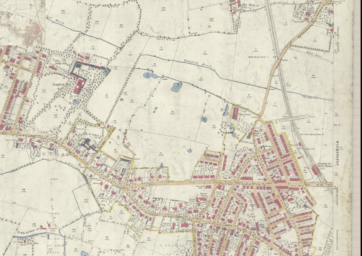
🗺️ Our volunteer researcher, historian Richard Bond, spent months piecing together historic maps, council records, engineering drawings and aerial photographs. Together these reveal the intriguing story of Longford Brook. The brook originally flowed from east to west across the north field and into Longford Park. When the clay pit in the north field was opened up between 1915 and 1932, the brook was temporarily diverted around Ryebank Fields. The diversion ran as an open watercourse along the eastern boundary, into a culvert (an underground channel) parallel to the Nico Ditch, then back up along the western boundary, before reconnecting with its original route in Longford Park. These maps from 1892, 1933, and 1950 show these changes. The brook was subsequently returned to its historic route, now culverted, beneath Ryebank Fields.
🕳️ The documentary evidence matches with our own investigations on the ground. Committee members identified a large double manhole in Longford Park, immediately beyond the Ryebank Fields boundary, and a further manhole on Ryebank Fields behind Peveril Crescent. These features lie on the same alignment shown in the historic engineering drawings, providing further evidence consistent with the documented route of the culvert beneath the site.
📨 Richard has shared this evidence with the developers, their Planning consultants (Turley), Manchester City Council, Trafford Council and the Lead Local Flood Authority (LLFA) for both Trafford and Manchester. As a result, the Manchester LLFA has asked the developers to review their drainage information and carry out further investigation into the culvert. Trafford Council has also indicated that there remains too much uncertainty to comment on the planning application until these issues have been investigated further.
⚠️ This sits alongside concerns already raised by other statutory consultees. United Utilities has questioned aspects of the drainage strategy and requested further assessment of the site’s drainage hierarchy and infrastructure before development proceeds. The Environment Agency has also required additional investigation of groundwater contamination and imposed conditions to ensure that any piling can only proceed where there is no unacceptable risk to groundwater or watercourses. Richard has also shared the evidence with both United Utilities, and the Environment Agency.
❓ Why does this matter?
🏗️ Understanding where Longford Brook actually runs is essential because buried watercourses influence flood risk, drainage design, contamination pathways and the engineering of any future development. If a culvert passes beneath proposed houses, it becomes a significant planning consideration, and would severely impact costs of buildings insurance and access to mortgages for any potential buyers. It is likely that a further redesign of the proposals will now be required before the Manchester planning committee can consider them.
🌍 The Environment Agency has already expressed concerns about contamination affecting groundwater and watercourses on the site. In addition, its conditions require any piling works to be carefully assessed to ensure they do not create unacceptable risks to groundwater or nearby watercourses.
📖 Building over culverted watercourses is generally considered poor practice and is strongly discouraged by local authorities. The importance of identifying culverted watercourses is also recognised in Manchester’s emerging Local Plan. The draft policy recommends that investigations of existing culverts establish “their full route, condition and capacity” through site-specific flood risk assessments ‘at the planning application stage’.
🤝 This work has been a remarkable example of community-led research. Piece by piece, volunteers have combined historical research with on-the-ground investigation to build an evidence base that is now being considered by the relevant authorities.
🔍 We still don’t know everything, and further investigation is clearly needed. But thanks to the persistence of local residents, we know far more about what lies beneath Ryebank Fields today than we did just a few months ago—and the story is still unfolding.
💚 What started as a single question—“Where does Longford Brook actually go?”—has become one of the most significant pieces of community-led research undertaken during the Ryebank Fields campaign.
August 2026
Friends of Longford Park
Latest Articles
BBC NW Weather. Last updated: 2026-10-08 22:38:44
10°C
Tonight (Today) Heavy Rain
southerly - 11mph
16°C
FridayLight Rain Showers
westerly - 14mph
13°C
SaturdayLight Rain Showers
westerly - 16mph